Check Water Levels
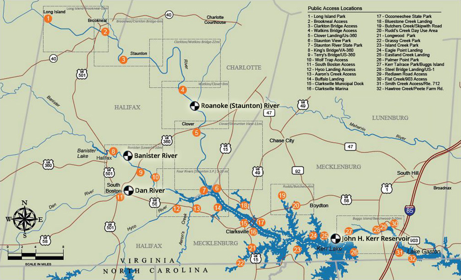
At normal levels, the rivers of the Southern Virginia Wild Blueway offer an enjoyable and family-friendly paddling experience. However, conditions can change quickly, so please use caution and check these links or click on the river gauge icons on the map below for accurate information. If you plan to enjoy the Blueway below the dam on Kerr Lake, you may call for a pre-recorded message regarding scheduled releases.
(Recorded message - no website available)
434-738-6371 x276
About
the Blueway
Consisting of three rivers and two lakes spanning Halifax and Mecklenburg counties, the Southern Virginia Wild Blueway offers a paddling experience unlike anywhere else in the country.
View
Maps
The Southern Virginia Wild Blueway is easy to access and fun to explore. More than 100 miles of navigable river, including 38 miles of designated Virginia Scenic River, are part of the Blueway.

Plan
Your Trip
Whether you’re looking for a few hours of fun with the family or a multi-day wilderness adventure for experienced paddlers, the Southern Virginia Wild Blueway offers everything you need.
FAQs
Find answers to our most commonly asked questions before beginning your Southern Virginia Wild Blueway adventure.
